
Hiking the Dadès Valley & Monkey’s Fingers, Morocco

A Berber village, Douar-Ait-Ouff, in the Dadès Valley, Morocco
We spent one week in Ait Oudinar, Morocco exploring the Dadès Valley and surrounding area, including the famous Monkey's Fingers slot canyon at Tamlalt.
Discovering the natural beauty of an ancient Berber valley
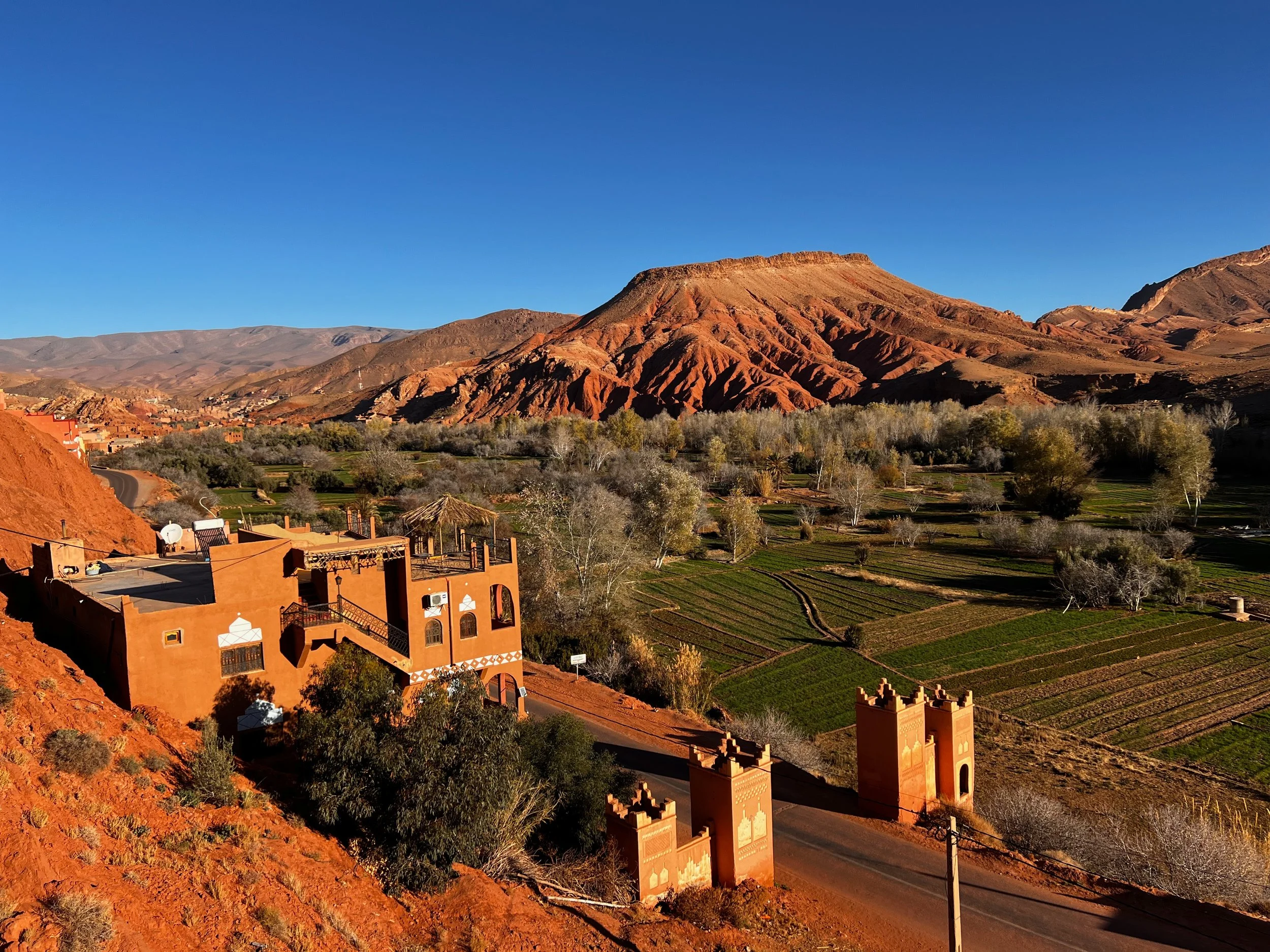
The Dadès Valley is a six-hour drive west of Marrakech and is most often visited by tourists as a detour on the journey to one of the Merzouga luxury desert camps. The valley runs from Boumalne Dades, on the major road west, north to the High Atlas mountain villages around M'semrir.
We stayed in a traditional mud-brick house recently renovated by skilled local craftsmen and tastefully decorated by the owners in the local Berber style with many beautiful rugs and more lights than we could count. The house is situated in Ait Oudinar where the road crosses the Dadès river before heading north again into the Dadès gorges. The village is located at an elevation of 1,668 metres which means cooler temperatures than the cities; we visited in January and it was cold at night with ice forming on the stream's edge.
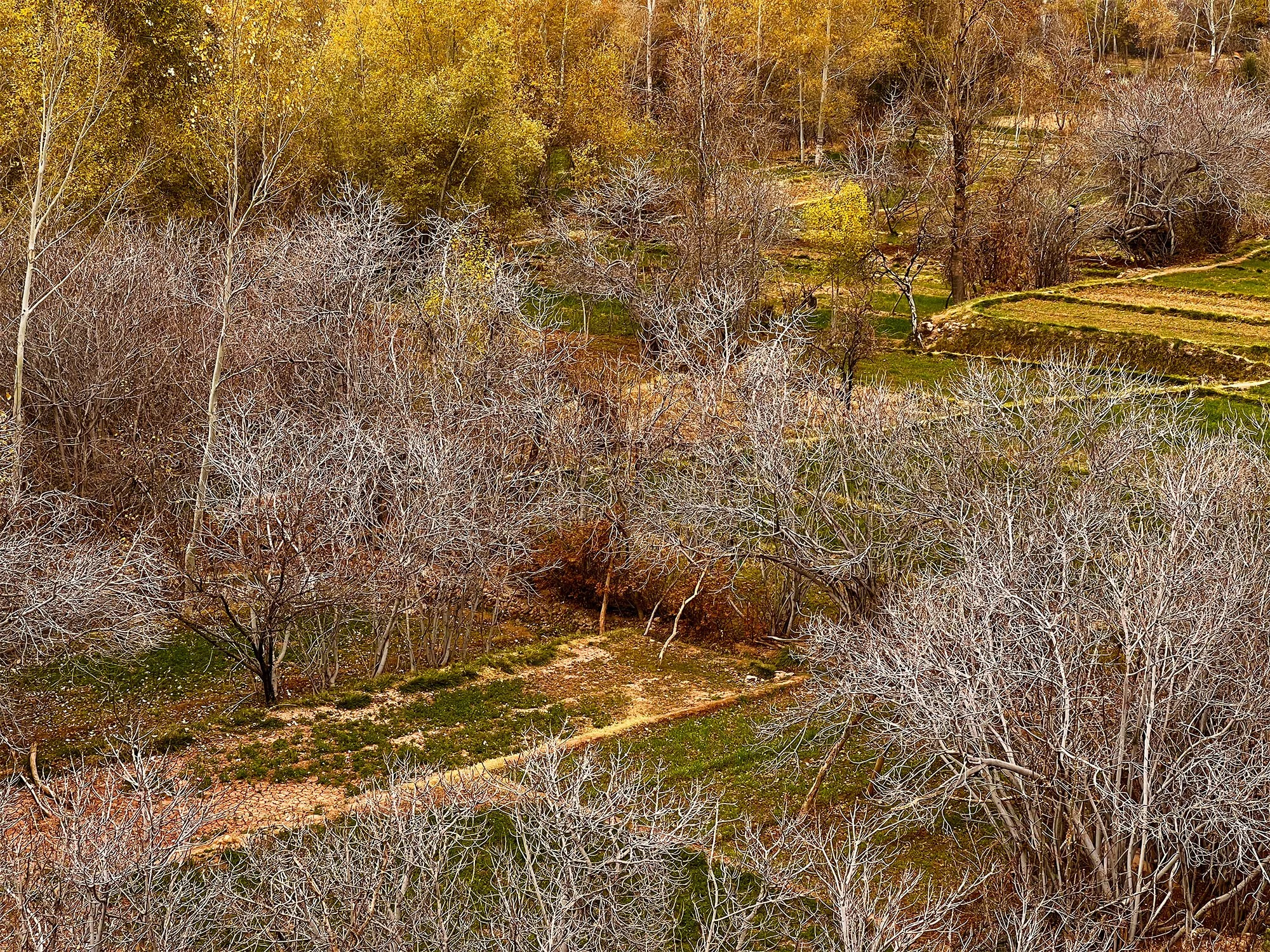
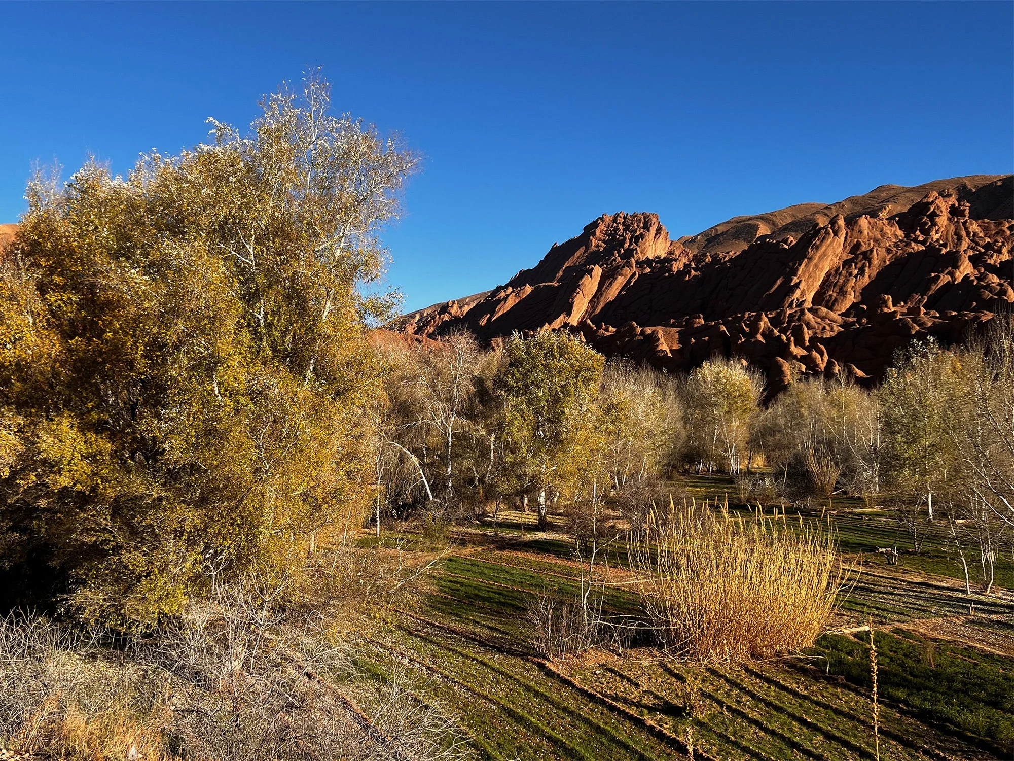
Below the house, the valley floor is verdant and rich in bird life due to the ingenious irrigation channels which supply precious water to fields of wheat and orchards of fig, almond and olive trees.
Entrance to the Dadès Valley, Morocco

Spectacular rock formations around every corner
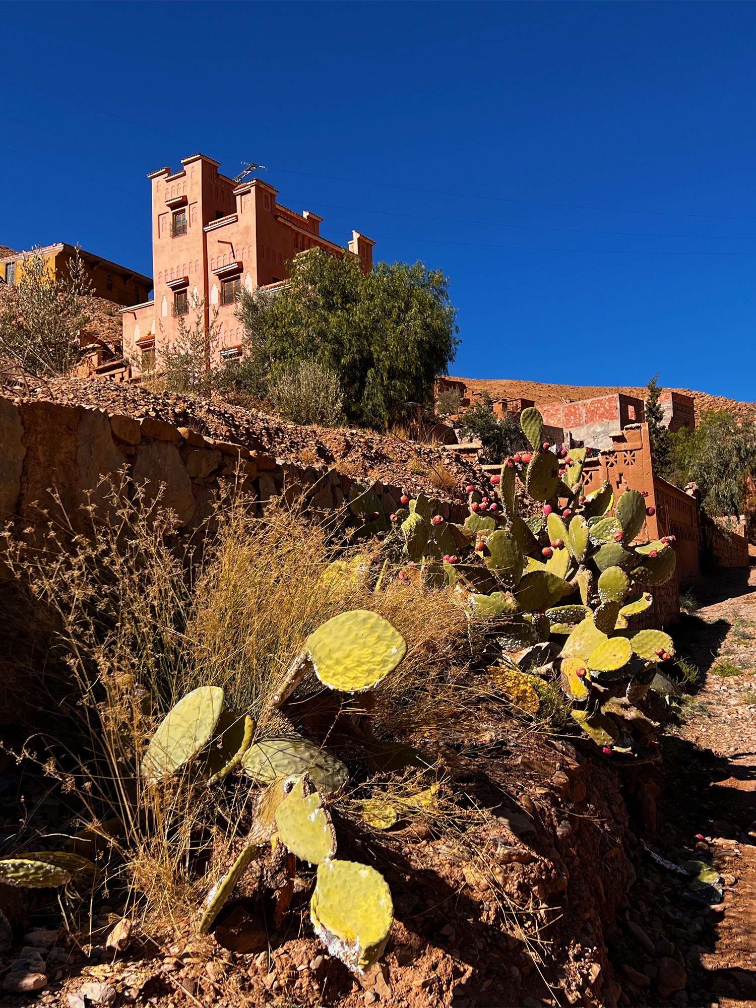
Numerous crumbling kasbahs and ksour (fortified villages) line the valley in the Berber villages of Aït Youl, Aït Arbi, Aït Oudinar, Aït Ouffi and Aït Toukhsine.


The valley floor reveals a verdant strip of life that provides vital subsistence farming
Walking in the Dadès Valley
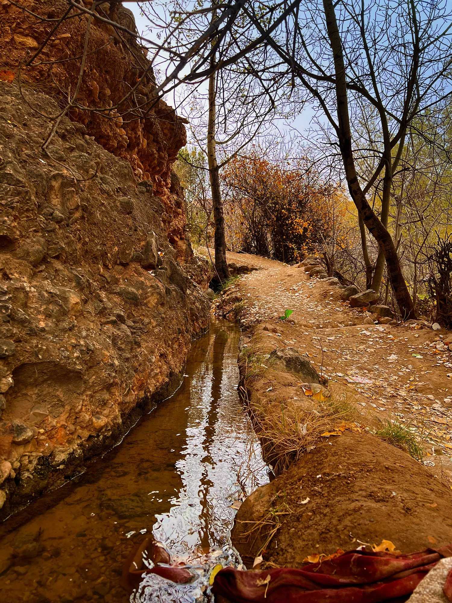
The irrigation channels are essential to sustain life
Red and green is the dominant colour scheme here. The hills to either side of the valley are a dusty rust hue dramatically pierced by thrusting rock formations of deep vermillion. Along the narrow valley floor runs a strip of lush greens and yellows, sadly interspersed with patches of drab pale earth, showing where the lack of precipitation during the last few years has left fields without water.
Stepping from our door, we drop into the trees and wander alongside the irrigation channels. We are immediately captivated by this cultivated land's colours, textures and patterns and bird songs. Looking up from the valley floor the village's houses blend seamlessly with the hillside above, which is not surprising when you realise that they are built using the same earth and rock.
The irrigation channels are often a traditional earth ditch with gaps plugged by rocks and earth. The plugs can be kicked open to flood a small field carefully landscaped into narrow strips with low earth walls to ensure an even saturation.
Agriculture on this scale is incredibly labour-intensive, with managing the irrigation system alone requiring daily attention. We watch a local tend a small plot of herbs and vegetables, and realise that everything here is done by hand. Subsistence farming on a tiny scale.
The soundscape is very soothing; a gentle burbling from the stream, chatters and chirps from a flock of rock doves, and an ancient hoe scratching the dirt. Five times a day, the peace will be broken by the call to prayer (adhān).
The Dades Valley is an excellent location for walking and trekking in Morocco, with fantastic rock formations, lush cultivated fields, wonderful bird songs, hundreds of kasbahs and genuine Berber villages.
Walking from Ait Oudinar to Tamlalt
A favourite walk was from our house in Ait Oudinar along the east side of the valley down to Tamlalt via numerous crumbling kasbahs and ksour (fortified villages). The scenery is spectacular, and the contrast between the arid mountains and the verdant valley floor is startling. Along the way, we discovered caves dug into the hillside, extraordinary rock formations and ruined buildings where the traditional construction methods can easily be studied. The ruined kasbahs can be explored but do not yield a great deal, most rooms are used as animal pens or have collapsed and caution is advised if you want to venture farther.
We met young girls taking herds of sheep and goats onto the hillside for better grazing, but it looked like slim pickings for the animals in the current drought conditions.
Lower down the valley, the rock formations become more dramatic as we approach Les Doigts de Singes (Monkey's Fingers), also known as "Cliffs of Tamlalt". The track leads through the small village of Ait Arbi before dropping to the entrance of the Canyon des Soigts du Singe opposite Tamlait.


The Monkey’s Fingers slot canyon


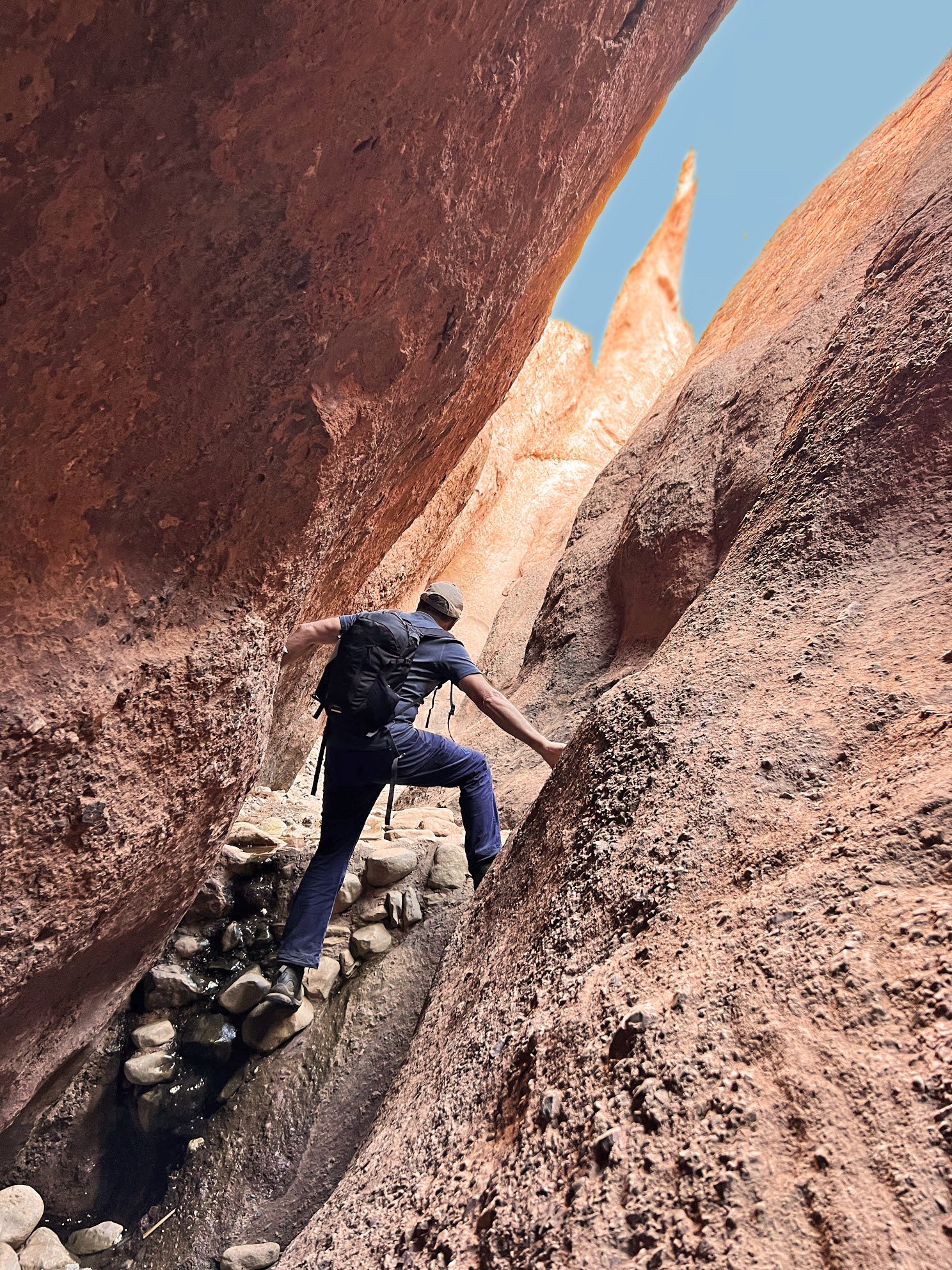
Enjoying the unique experience of hiking the Monkeys’ Fingers slot canyon in the Dadès Valley
The rock formation known as Monkey's Fingers is most often photographed from the village of Tamlalt on the opposite side of the valley. The fascinating rock upthrust appears pebbled—weathered rock sections have "digits" made of a conglomerate of boulders that rest in a unique formation, utterly different from any other section within the gorge. As the name implies, it appears as though a hand is rising up from the river below.
The Monkey's Fingers can be easily approached from Tamlait by crossing the valley floor or by the track on the east side of the valley from Ait Oudinar.
Hiking the slot canyon is a unique experience. It twists and turns its way back into the hillside, restricting your view ahead to just a few meters and, at times, narrows to just 500mm wide. The waterway has lots of clambering over and under boulders and restrictions. Occasionally, a stretch of water needed to be bypassed (but maybe only in winter?) by using the rock walls.
The scenery is impressive. The rock walls close over your head in places, and the experience is similar to caving but in the light.
The canyon is approximately 1 km long and takes 45-60 minutes to navigate. The return journey can be taken on a hillside track to the left of the canyon and rewards with more staggering rock scenery. I had lots of fun and reversed my route to prolong the experience.
I have read descriptions of this trail as being an easy walk. Well, it will be straightforward if you are an experienced mountain hiker, but it will be problematic if you are a weekend rambler. There are sections where you will be scrambling and two short passages that some may find intimidating. I met a few people who decided to turn back halfway and experienced difficulties reversing the scrambling sections. If in doubt, hire a local guide.
A summary of hiking in the Dadès Valley
The Dades Valley is an excellent location for walking and hiking in Morocco. The vividness of the colours and the dramatic scenery will require many stops for photography.
There are many small Berber villages, and their hospitality is second to none. There is always a place to eat and something to explore, and if you want solitude, you can always find a trail that leads to peace and quiet.
Detailed maps of the area do not exist, and a reasonable degree of experience and judgement is needed before venturing away from the valley floor. I spent an afternoon wandering the hills above Ait Oudinar using maps.me for guidance. The track up was accurate, but this disappeared once on the plateau to be replaced by myriad faint trails. The track down disappeared once I left the plateau leaving me scratching for a route through very steep and loose terrain. I advise hiring a local guide.
Recommendations
Chez Pierre
An excellent restaurant with lovely accommodation. Friendly and good value.
Sahara Atlas Tours
Customised tours and day excursions.
Plein Desert
Customised tours and day excursions.